Ballywiheen/Baile Uí Bhaoithín
Early Christian Site
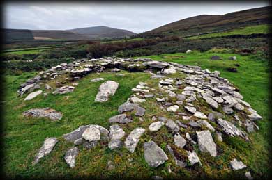
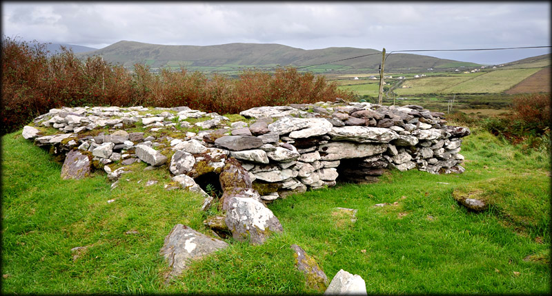
This early Christian settlement is situated on the slopes of Croaghmarhin mountain. The southern side of the 68 metre enclosure is dissected by a modern roadway. In the eastern sector are the remains of an early drystone oratory. The east wall is almost completely collapsed and the other walls vary from 0.5 to 0.9 metres in height. Although the interior is mostly filled in, it is still possible to make out the internal size of the oratory. The original roof would have been corbelled, see Gallarus.
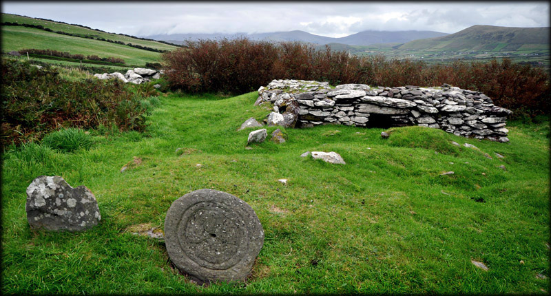
Immediately west of the oratory are two mounds that mark the location of two leachts or stone altars. The shape of the northern leacht is more defined. The presence of grave mounds in the northern section of the enclosure suggests it was used as a calluragh burial ground. Further west of the stone altars you can see the upper portion of a cross slab, pictured in the foreground above.
Oratory from the northeast
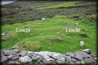
Location of the two Leachts
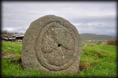
West Face
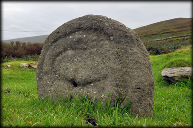
East Face
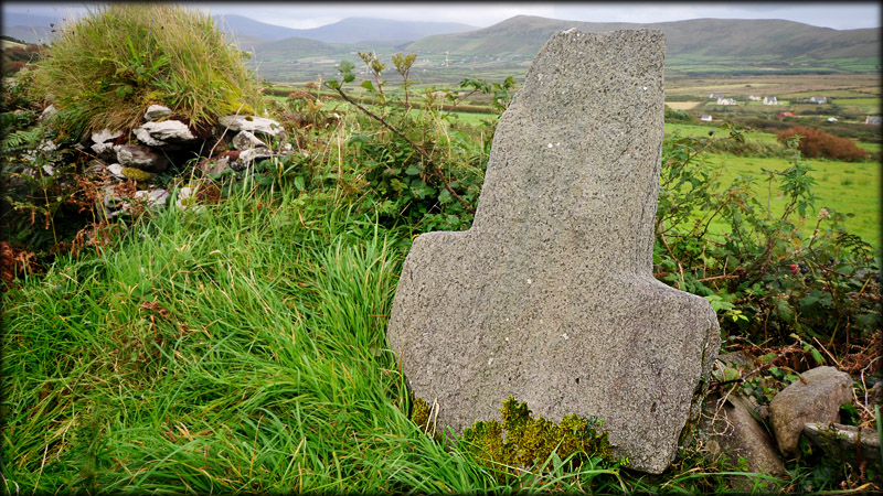
On the southside of the road to the east of the enclosure is a 1.23 metre high plain stone cross, pictured below . Like the slab, most of the shaft is buried below ground. The views of the valley from here are quite stunning. There are the remains of at least thirty ecclesiastical sites on the Dingle peninsula. Gallarus, Kilmalkedar and Reask are probably the most well known and most visited.
In the image below you can see a holed stone to the right of the entrance that acted as a pivot for the door.
Situated: From Ballyferriter village turn left at the Church, opposite the Museum. Drive for 1.6 kilometres. If you see a ruined stone wall on your right. You are inside the enclosure.
Discovery Map 70: Q 3529 0348. Last visit Sept 2012.
Longitude: 10° 24' 26" W
Latitude: 52° 9' 31" N
Photos: Jim Dempsey and Deb Snelson.
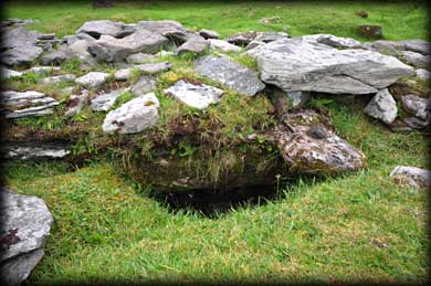
Entrance interior with pivot stone